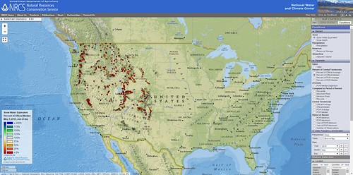
The new, interactive map lets you compare current snowpack data to historical records.
Western snowpack, where it remains, is in full melt.
All along the Cascades and Sierra Nevada are ski courses that never opened, bare mountains and snowless SNOTEL sites where snowpack is measured. Where snow accumulated, it melted prematurely during a warm March. One of the most common questions for snow surveyors has been: how does this winter compare to the past?
A new, interactive map shows you exactly how it compares. The online map, just released by the USDA’s Natural Resources Conservation Service, shows regularly updated current conditions – alongside historical records – for the entire NRCS snow survey network.
During a brief demonstration, NRCS Hydrologist Cara McCarthy put the map through its paces. Zooming in, we saw a table detailing current conditions at a SNOTEL site in Montana; next, a map comparing California precipitation, April 2015 and April 1993; then, a color-coded view of the entire West, ranking current conditions with respect to historical averages.
Each transition just took a couple of clicks.
Snowpack data in the new map is also more accurate, as it’s updated several times a day with edited information. Previously, static snowpack maps were posted with raw data and were not updated even if data changed. Now, when snow surveyors review the data and account for errors resulting from malfunctioning equipment, that new information will soon be available.
“With this map, there are so many ways to look at the data,” McCarthy said. “It’s easy to customize your search and compare different areas, or different years. You can focus in on a single county, or look at the entire West.”
This information used to be hard to find, cumbersome to extract and inconvenient to calculate. Now, it’s presented in an intuitive map that lets users quickly sort through a wealth of current and historical records. Whatever you’re looking for, with respect to NRCS snow survey data, there’s a great chance you’ll find it here.
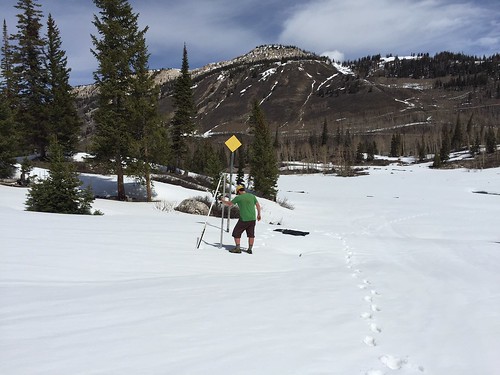
Spring arrived early. Utah Snow Surveyor Beau Uriona dresses for comfort while measuring snow at Mt. Baldy Snow Course on the Wasatch Plateau. Photo by Jordan Clayton.
No comments:
Post a Comment
Note: Only a member of this blog may post a comment.