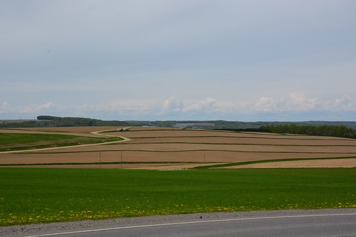
Potato production is an important part of the Black Brook Watershed’s landscape. Photo credit: J. Owen /Agriculture and Agri-Food Canada
When thinking about how to reduce run-off from potato fields in New Brunswick, Canada, researcher Josée Owen of Agriculture and Agri-Food Canada turned to a tool created by Mike Dosskey, a U.S. Forest Service researcher at the USDA National Agroforestry Center.
With others at the University of Kentucky and the Forest Service, Dosskey created AgBufferBuilder, a GIS-based computer program used for designing vegetation buffers around agricultural fields. Soil can erode, and fertilizer and pesticides off of fields while suspended in water. Buffers with trees, shrubs and other plants help to filter this water by trapping sediment and nutrients.
The AgBufferBuilder program analyzes the lay of a field to determine where and how-much runoff will occur. The user selects the target level of trapping efficiency desired and the program uses GIS technology and other user inputs to create recommendations of where and how much buffer is needed to achieve different levels of effectiveness.
Owen used this tool to study the Black Brook Watershed in New Brunswick, where around 65 percent of the land is in agriculture, about half of that produces potatoes, which are notoriously hard on soil. In Maritime, or eastern Canada, potato fields are tilled repeatedly. Harvesting and other activities also disturb the soil. On about half of the farmland in the watershed, farmers have already implemented best management practices, including buffers. Because planting buffers costs money, farmers want to plant buffers where their investment has the greatest impact.
Owen used AgBufferBuilder to assess how effective the existing buffers are at trapping sediment. She then used the tool to analyze alternative buffer designs to trap more sediment. The tool showed that in one sub-basin, simply by being relocated, the same area of buffer could increase the amount of sediment trapped from 16 to 76 percent. Overall, the analysis demonstrated that in some areas, farmers could have more effective buffers at the same or less cost.
The collaboration between the U.S. and Canada on agroforestry has been important to accomplishing the missions of both agencies.
NOTE: For an interactive look at USDA’s work in conservation and forestry over the course of this Administration, visit http://medium.com/usda-results.
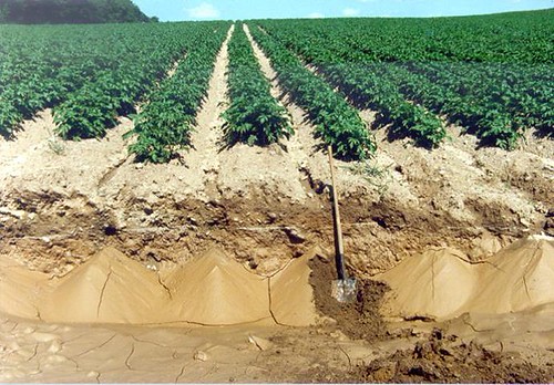
Potato fields often lose soil through erosion each time the the soil is turned, but buffers can help. Photo credit: Herb Rees and Sylvie Lavoie / Agriculture and Agri-Food Canada
No comments:
Post a Comment
Note: Only a member of this blog may post a comment.