Do you know how bad your jeans are for the environment? Or how many chemicals are needed to produce a pair of leather shoes? Luckily, there are some more environmentally friendly options available.
Fashion: A Look at Clothing Beyond Cotton and Leather - SPIEGEL ONLINE
Thursday, March 24, 2016

Wednesday, March 23, 2016
Whooping Cranes
From Quivira National Wildlife Refuge:

On the flats this morning: 4 adult Whooping Cranes. These were first reported last night, and were still present at first light today. It is always a treat to see these!

On the flats this morning: 4 adult Whooping Cranes. These were first reported last night, and were still present at first light today. It is always a treat to see these!
Kentucky “Landowner of the Year” Makes Conservation a Way of Life
From the #USDA:

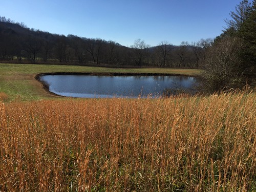
Burchel Blevins of Knox County, was named the ‘Landowner of the Year’ for the southeastern region, by the Kentucky Department of Fish and Wildlife.
When Burchel Blevins drives visitors around his rural Kentucky farm, he points out the numerous conservation practices he has implemented to protect and preserve his land. Blevins owns more than 650 forested acres and 70 acres of open forest and grass land in different parts of Knox County, and he’s worked with USDA’s Natural Resources Conservation Service (NRCS) for about 15 years.
“You learn a lot working with them,” said Blevins, referring to NRCS staff.
Using NRCS programs like the Environmental Quality Incentives Program (EQIP), Conservation Stewardship Program, Wetland Reserve Easement (WRE) and the former Wildlife Habitat Incentive Program (now part of EQIP), Blevins has made many conservation improvements to his land.
He created snags and den trees to enhance wildlife populations and improve timber quality and production; established native warm-season grasses to benefit wildlife; planted a variety of grasses on a one-acre plot to attract pollinators; utilized patch clearcutting to create new and improved wildlife habitats that will provide an influx of annual plants and food sources; installed shallow water areas for wildlife and amphibians; and maintains wildfire breaks. And, he has more than 30 acres enrolled in a perpetual wetland reserve easement that takes marginal agricultural land and converts it back into natural wetlands.
Blevins work doesn’t go unrecognized. The Kentucky Department of Fish and Wildlife awarded Blevins as “Landowner of the Year” in Kentucky’s southeast region, citing his continued dedication to conservation maintenance, improving wildlife habitat – as well as improving education, outreach and recreational activities.
“This award meant a lot to me because I really appreciate the opportunity to do this,” said Blevins. “The land has been good to us and we can do the same.”
His conservation work is especially important in Knox County, which is a persistent poverty area targeted by USDA’s StrikeForce Initiative for Rural Growth and Opportunity. In StrikeForce areas, NRCS staff works with state, local and community officials to increase awareness of USDA programs and help build program participation through intensive community outreach and technical assistance.
On January 15, 2016, Vilsack announced the expansion of StrikeForce into high-poverty counties in Florida, Missouri, Montana and Ohio. Altogether, 970 counties, parishes, boroughs and census areas in Alabama, Alaska, Arizona, Arkansas, Colorado, Florida, Georgia, Kentucky, Louisiana, Mississippi, Missouri, Montana, Nevada, New Mexico, North Carolina, North Dakota, Ohio, Oklahoma, Puerto Rico, South Carolina, South Dakota, Tennessee, Texas, Utah, Virginia and West Virginia are now eligible for “intensive care” through StrikeForce.
Farmers interested in learning more about conservation and land management practices, visitwww.nrcs.usda.gov/GetStarted.
Blevins installed this pond near a grove of chestnut trees to serve as a food source for wildlife on his land.
Conservation versus Preservation?
From the #USDA:
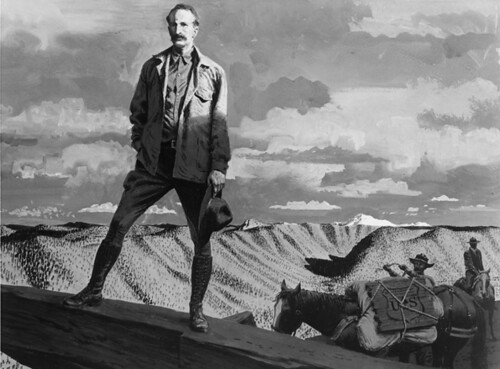
A portrait of Gifford Pinchot on a national forest. Pinchot was the first Chief of the US Forest Service which was founded in 1905. Photo credit: US Forest Service
Have you ever wondered why your favorite National Park is surrounded by a National Forest? Well, it didn’t happen by accident or guesswork. The fact is, it was all started over 100 years ago by two men I like to refer to as the founding fathers of America’s public lands.
Back at the turn of the 20th Century Gifford Pinchot and John Muir had radically contrasting views of how to manage America’s wild lands and they worked tirelessly lobbying Congress and convincing Presidents to agree with them to start protecting open space.
Muir promoted preservation and Pinchot advocated for conservation.
Pinchot’s vision of managed conservation basically meant that lands owned by the federal government could not only be used for recreation by the general public but could also be used, responsibly, by industry for logging, mining and many other purposes including extensive scientific research on tens of thousands of acres of land.
Pinchot, who would eventually start and serve as the first chief of the US Forest Service that now manages or conserves 193 million acres of forested and grass lands, prevailed overall. He had help, though. President Theodore Roosevelt agreed that conservation was the best practice for the majority of federally owned lands.
The adoption of the conservation model resulted in national forests being multi-billion dollar economic engines for hundreds of small towns and communities across America. If you like winter sports, there’s a good chance that your favorite ski run is on a national forest. The same goes for swimming, hiking and camping. And, there’s a good chance that the house you live in, and some of the furniture you sit on, was built by wood harvested from a national forest.
Another of Pinchot’s concepts from his wild lands conservation philosophies resulted in creation of theForest Products Lab, the world’s preeminent wood research laboratory and a behemoth of technology and invention located in Madison, Wisconsin. Pinchot’s vision of managing forests for profit fit into his life mantra: The Greatest Good for the greatest number…”
But Pinchot’s success was not at the expense of John Muir’s preservation legacy aimed at permitting little to no industrial profit from the federal lands that have become our National Parks. In fact, Muir’s vision resulted in protecting forever some of the nation’s most iconic open spaces totaling over 100 million acres managed by an agency that was to be called the National Park Service.
Despite arguments by some, Muir’s preservation and Pinchot’s conservation philosophies are not at odds. In fact they play, together, a huge role in protecting our natural open spaces—for generations to come.
This “working together” philosophy of land management can perhaps best be seen by looking at a map of a large national park say Yellowstone or Yosemite or Shenandoah. You’ll notice that these parks (and many others) are connected to, or completely surround by, national forests or grasslands managed by the Forest Service.
For more than 100 years the success of the dual strategy of conservation and preservation has grown more and more obvious to the millions who benefit from jobs created and those who enjoy the wild places. Throughout the world other nations seek to emulate our federal land management system.
Thanks to Pinchot and Muir our federal dual system of conservation and preservation land management works in practical ways to keep our public lands open and productive.
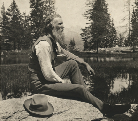
John Muir was a founding father of the American outdoors preservation movement which resulted in the establishment of the US Park Service in 1916. Photo credit: US Park Service
Celebrating World Water Day along the Eastern Continental Divide
From the #USDA:
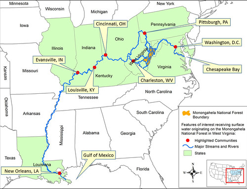
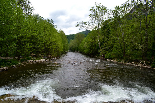
Streamflow that originates on the Monongahela National Forest flows to the Chesapeake Bay and the Gulf of Mexico. During that journey, it supplies drinking water to many municipalities in nine states and Washington, DC. (US Forest Service graphic)
Today, March 22, is World Water Day, and the U.S. Forest Service joins the international community in celebrating water and inspiring good stewardship of this vital resource. Forests are essential to our survival and well-being due in large part to the ecosystem services they provide, including our fresh water.
Surface water that originates on our national forests has many important purposes, one of which is providing drinking water for millions of people in the United States. Surface water is water in rivers, streams, creeks, lakes and reservoirs. Surrounding trees and forests play a major role in keeping these waterways clean and healthy.
Forest trees prolong streamflow, control erosion, and maintain high-quality water. One such example is in the Monongahela National Forest in West Virginia.
The Monongahela water system’s impact is both near and far. Streamflow that originates on the forest flows to the Chesapeake Bay and all the way to the Gulf of Mexico. During the journey, it supplies drinking water (surface water) to municipalities in nine states and the District of Columbia. This includes a number of major cities and millions of people living along the way in places like Cincinnati, Louisville, Pittsburgh and Washington.
Seneca Rocks National Recreation Area, West Virginia.
You may be wondering how in the world water from the uplands of West Virginia can provide drinking water to people located in divergent directions and so far from the national forest? It’s thanks to more than 2,600 miles of perennial streams and rivers within the Forest’s boundaries, abundant rain and snow, and the Monongahela’s position along the Eastern Continental Divide.
West Virginia lies completely within the Appalachian Mountain region. It is categorized into three major provinces – The Allegheny Plateau (west and north), the Allegheny Mountains (southwest and northeast) and Ridge Valley (east of the Allegheny Front).
The Allegheny Mountains create a rain shadow, concentrating rain in the mountains and causing the western part of the state to receive much more precipitation than the eastern panhandle. The most northeastern part of the Monongahela receives the least amount of precipitation, just under 40 inches per year on average because it lies in the rain shadow.
By contrast, high elevation areas in the central and southern parts of the Forest receive at least 60 inches of precipitation annually. Almost half of that precipitation becomes streamflow, providing drinking water for downstream communities and supporting many species of fish and other aquatic organisms.
The Eastern Continental Divide creates two divisions in this streamflow—one flowing east to the Chesapeake Bay and the other flowing west and north and eventually south to the Gulf of Mexico. This translates into drinking water and other water resources for families and businesses across a huge water shed flowing through a large part of the eastern United States including West Virginia, Maryland, the District of Columbia, Ohio, Virginia, Pennsylvania, Kentucky, Indiana, Illinois and Louisiana.
So, on World Water Day, we encourage you to raise a glass of cool, refreshing water to the forests that help keep it clean and the amazing waterways that bring it to you.
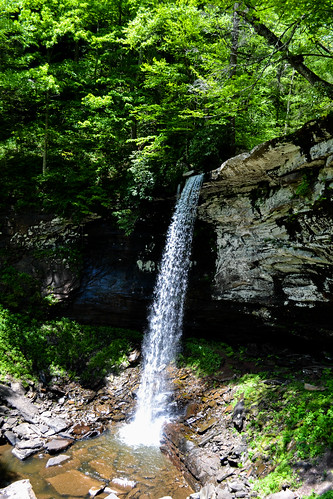
Waterfall on the Monongahela National Forest.
Glacier Bay National Park
From the U.S. Geological Survey (USGS):

Follow the research adventures of scientists from the University of Maine, USGS, NOAA, and NPS during their Deepwater Exploration of Glacier Bay National Park http://
During the mission USGS research geneticist Cheryl Morrison will be leading nighttime Remotely Operated underwater Vehicle (ROV) ROV operations and collecting samples of red tree coral (Primnoa pacifica) for an on-going studies of connectivity and food webs among Gulf of Alaska and fjord populations.
The photo by Cheryl Morrison/USGS is of the Mendenhall Glacier, as the research vessel prepares to head out to sea.

Follow the research adventures of scientists from the University of Maine, USGS, NOAA, and NPS during their Deepwater Exploration of Glacier Bay National Park http://
During the mission USGS research geneticist Cheryl Morrison will be leading nighttime Remotely Operated underwater Vehicle (ROV) ROV operations and collecting samples of red tree coral (Primnoa pacifica) for an on-going studies of connectivity and food webs among Gulf of Alaska and fjord populations.
The photo by Cheryl Morrison/USGS is of the Mendenhall Glacier, as the research vessel prepares to head out to sea.
International Day of Forests 2016
From the #USDA:
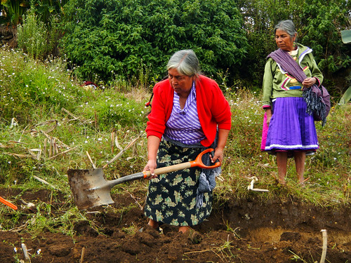
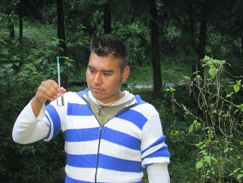
Alternare instructors demonstrating proactive land management practices. Photo credit: Alternare
March 21, 2016 marks the United Nations’ fourth annual International Day of Forests, a day to celebrate the important and diverse contributions of the world’s forests. As it has from the start, theU.S. Forest Service commemorates the day and works with international partners throughout the year to protect the health of forest ecosystems worldwide.
For over 50 years, the U.S. Forest Service (USFS) has partnered with Mexico and Canada through the North American Forest Commission, one of six regional forestry commissions under the UN Food and Agriculture Organization.
To the south, USFS works closely with the National Forestry Commission of Mexico, CONAFOR, the National Protected Area Commission, CONANP, and the Fondo Mexicano para la Conservación de la Naturaleza, FMCN, on a range of issues covering sustainable forest management, fire management, forest genetics, climate change mitigation, urban programs, and insects, diseases and invasive plants. In Central Mexico, the connection between forests, wildlife habitat, and water is clear. The forested areas of the Monarch Butterfly Biosphere Reserve provide shelter for overwintering monarchs and capture rainwater that ultimately flows into two of Mexico’s largest river basins. Most importantly, the forest provides water to local communities.
However, the quality of the water that originates in the forested hills within the reserve was poor and led to human illnesses. As a result of this public health issue, Alternare, AC, a local nongovernmental organization and partner of the USFS, launched a water monitoring project in 2009 through funding from the Fundación Gonzalo Río Arronte and expertise from the Universidad Nacional Autónoma de México. The partnership empowered communities to pinpoint sources of contamination and develop local solutions.
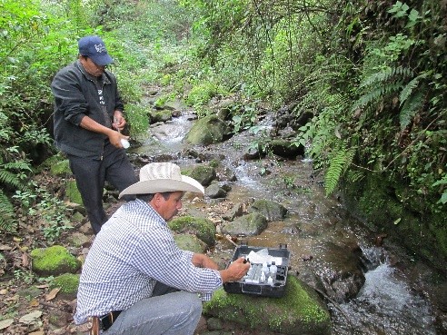
Measuring physical characteristics and chemical parameters of water in Agua de Benita, Nicolas Romero, Michoacan, Mexico. Photo credit: Alternare
“There was always a risk that family members, especially children, could get sick from drinking contaminated water. We were searching for ways to work with communities to diminish this risk,” said Guadalupe del Río, President of Alternare.
Alternare trained campesinos, or local farmers, to conduct samplings, analysis and evaluation of water quality. Two main causes of contamination were detected: livestock wandering into streams and outhouses placed near water sources.
To rectify these problems, livestock were penned well away from water sources and dry toilets were constructed in homes and schools. Local teachers were included in Alternare’s outreach to educate students. Families were taught how water can be contaminated through the subsoil, even if springs and streams appear to be at a safe distance.
In 2014, in partnership with the U.S. Forest Service and with funding from the U.S. Agency for International Development, additional monitors were trained in five communities. To date, over 250 dry toilets have been built and numerous cisterns constructed to collect rainwater for times of drought. This year, three additional communities will be added to extend the benefits of this partnership to more than 7,500 families.
Program participant measuring levels of dissolved oxygen in the water in the Francisco Serrato Community, Michoacan, Mexico. Photo credit: Alternare
Subscribe to:
Posts (Atom)